

Satellite Band Combinations are extensively used for Image Interpretation to highlight certain feature or to identify a certain material from the satellite imagery.
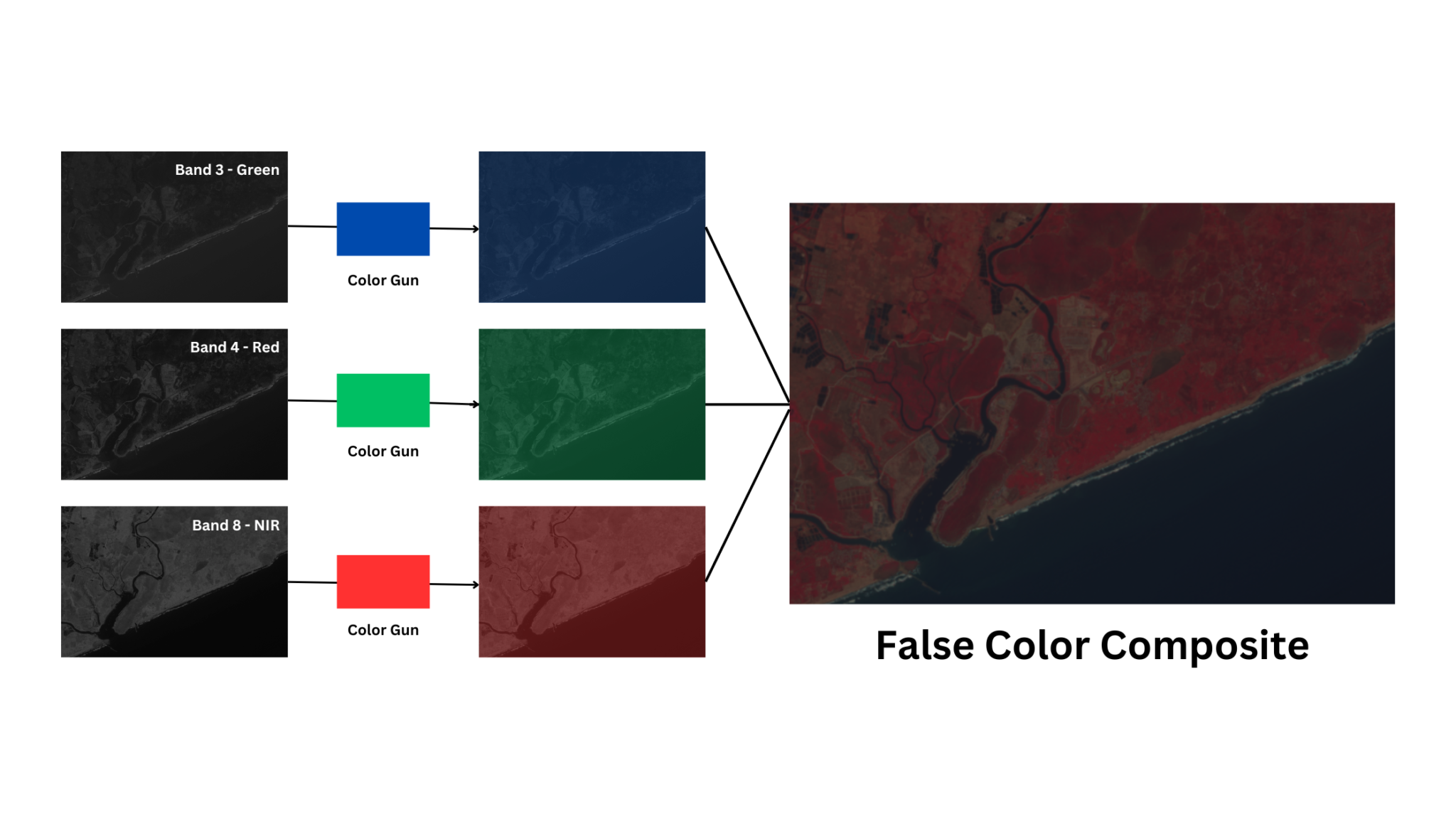
This is possible by assigning invisible spectral bands to red, green, and blue channels. For example: Near Infrared is invisible to human eye but it can be assigned Red color on the color gun of the computer. This helps in creating false color composites. The corresponding DN values of each pixel in a single band satellite image determines resultant colors in a color composite.
We have created an interactive tool to help you understand Satellite Band Combinations. The application uses images taken from Sentinel-2 satellite with 13 bands.
How to download Sentinel 2 data
This interactive tool lets you explore different Satellite Band Combinations. Try some of these band combinations.
True Color
B4,B3,B2
False color
B8,B4,B3
False color (urban)
B12, B11,B4
Explore Satellite Band Combinations
Contains modified Copernicus Sentinel data [2024] processed by Sentinel Hub
How to use
Let us try to explore a false color composite by selecting Band 8 for red, Band 4 for green and Band 3 for blue. This creates a false color composite displaying vegetation in red color. It may take a while to load the image for the first time.
You can observe that the application loads instantly after the first use. Explore different satellite band combinations of your choice and see how the features are highlighted.
Explore More WEBAPPS
Geocache – Andhra University, Visakhapatnam
Credits
Copernicus Sentinel data 2024 processed by Sentinel Hub
Copernicus Data Space Ecosystem
References
https://dataspace.copernicus.eu/explore-data/data-collections/sentinel-data/sentinel-2
https://sentiwiki.copernicus.eu/web/s2-applications
https://gsp.humboldt.edu/OLM/Courses/GSP_216/lessons/composites.html